

My name is Ingo Scholtes and I am a researcher based in Zurich, Switzerland. When I’m not in my office doing research, I enjoy spending my free time outdoors doing landscape and nature photography. Since about 10 years, this has become a growing passion and you can find some of my photographic works on my personal website, my profiles at 500px or you can follow @ingo_s on Twitter. You may also already know some of my works from the Windows Themepacks Scenic Europe, Scenic Europe 2 or Yosemite Scenes which were recently published by Microsoft.
In September 2015, I set off for a one week trekking tour through the Western Highlands in Scotland. Two years earlier, I had done my first tour in Scotland, hiking 140 km across the Isle of Skye. The rugged and wild landscapes, the magical light as well as the people left a lasting impression and the wish to come back started to grow quickly after my return. This time, together with my cousin, I decided to hike 125 km along the West Highland Way, a trail which has repeatedly ranked among the ten most beautiful hikes in the world. Just like two years before, we were fully equipped with camping gear, thus leaving us a lot of flexibility to change our plans, explore the wilderness and pitch our tent wherever we found a nice location.
Apart from a backpack full of camping equipment, I carried roughly 10 kilograms of photographic gear, in particular
- a Nikon D750 body,
- a 14-24 mm f/2.8 wide-angle lens,
- a 24-70 mm f/2.8 standard zoom,
- as well as a 70-300 mm f/4.5-5.6 VR tele zoom.
In addition, I carried a compact Manfrotto tripod, a monopod (which doubled as a trekking pole), a neutral density filter, an angular viewfinder for low angle shots, a bunch of SD cards, four spare camera batteries, a 15Ah power tank and a portable charger. A quick analysis at the end of the tour revealed that I shot 71 % of all pictures with the 24-70 mm lens, 22 % with the 14-24 mm lens and 7 % with the 70-300 mm tele lens. However, this is probably more of a result of my personal photographic preferences than a general rule.
The route: From Balmaha to Fort William
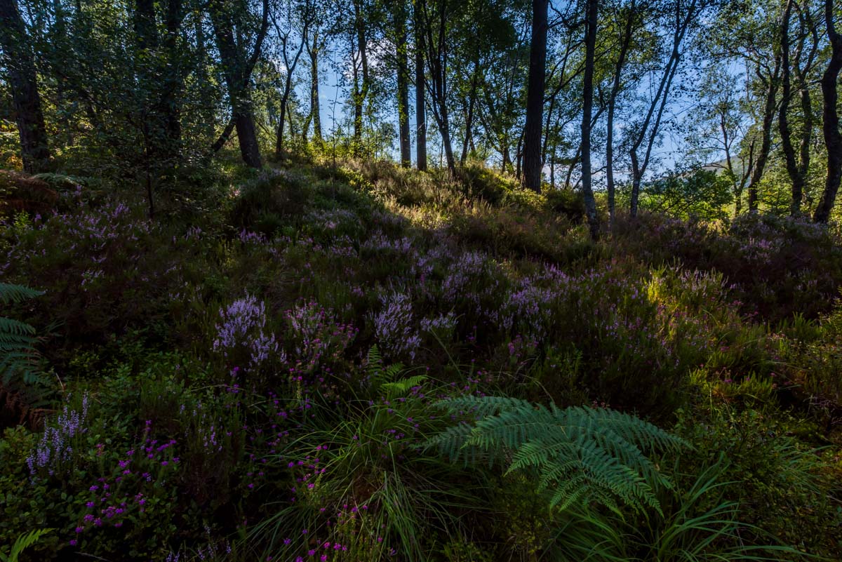
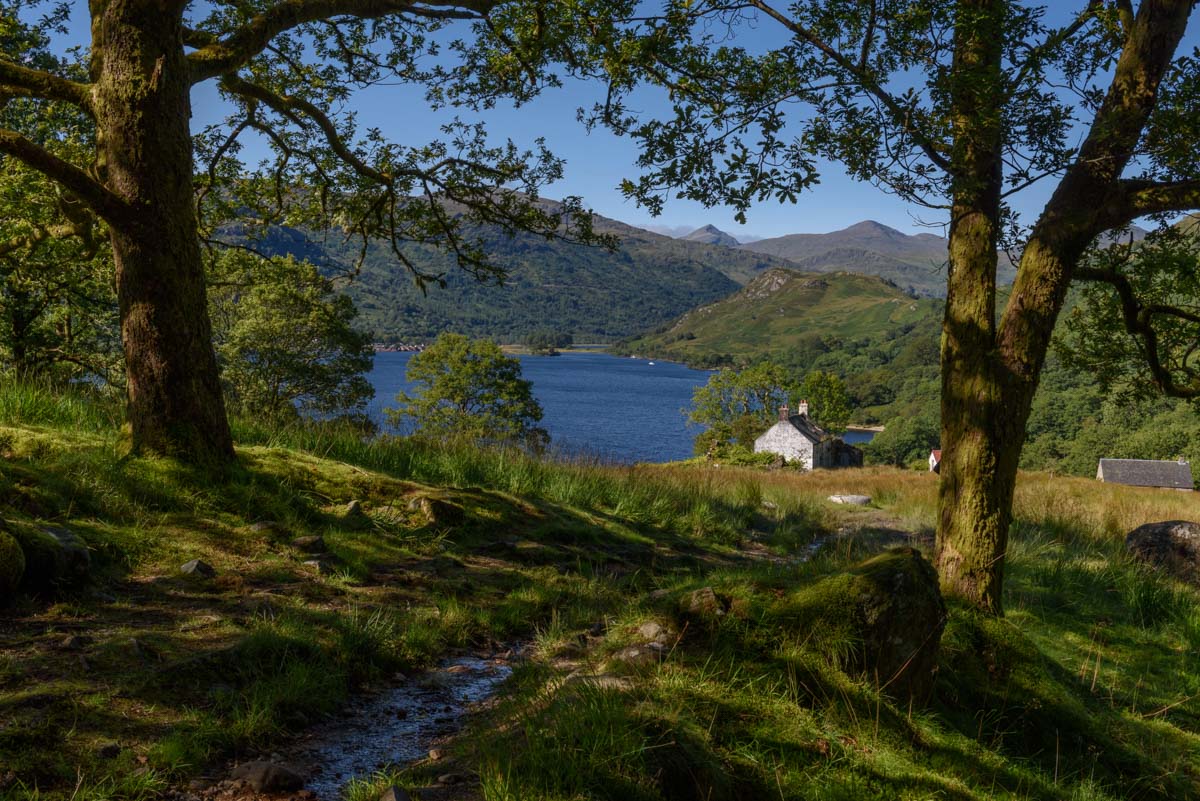
After weeks of planning, our tour starts on a cloudy afternoon in Balmaha, a small village located at the south-eastern banks of Loch Lomond, the largest lake in Scotland. The first three days of our tour take us around 40 kilometers along the eastern shore of Loch Lomond, finally reaching Beinglas at its northern end. Passing along the edge of the wooded foothills of the Grampian mountains, the West Highland Way provides us with plenty of fantastic views over the lake and the surrounding mountains. The narrow trail passes along beautiful deserted beaches, through dark forests and – especially in the northernmost part – extended fields of fern. We generally pitched our tent whenever we found a nice spot like, e.g., at a small beach near Inversnaid, where – in an impressive cascade of waterfalls – the water of the river Snaid pours into Loch Lomond. In the south-eastern part of Loch Lomond – north of Balmaha and south of Rowardennan – wild camping is forbidden from March until October. We thus spent the first night at an official campsite in Sallochy, which provides a small number of beautiful natural tent pitches directly by the lake. As an alternative, you can also book a room at the Rowardennan Youth Hostel a few kilometers north of Sallochy. North of Rowardennan, the terrain becomes difficult and a narrow trail winds itself up and down steep and rocky hills, partly being exposed high above the lake. Walking with heavy backpacks, this not only considerably slowed us down on the second day of our trek, it can also be dangerous especially when the trail is slippery after rainfall. Nevertheless, after 40 marvelous kilometers and a net walking time of 10 hours, we safely arrived in Beinglas, where we pitched our tent to spend the night.

At Sallochy campsite, we spend a memorable and calm first evening, pitching our tent at the shore of Loch Lomond.
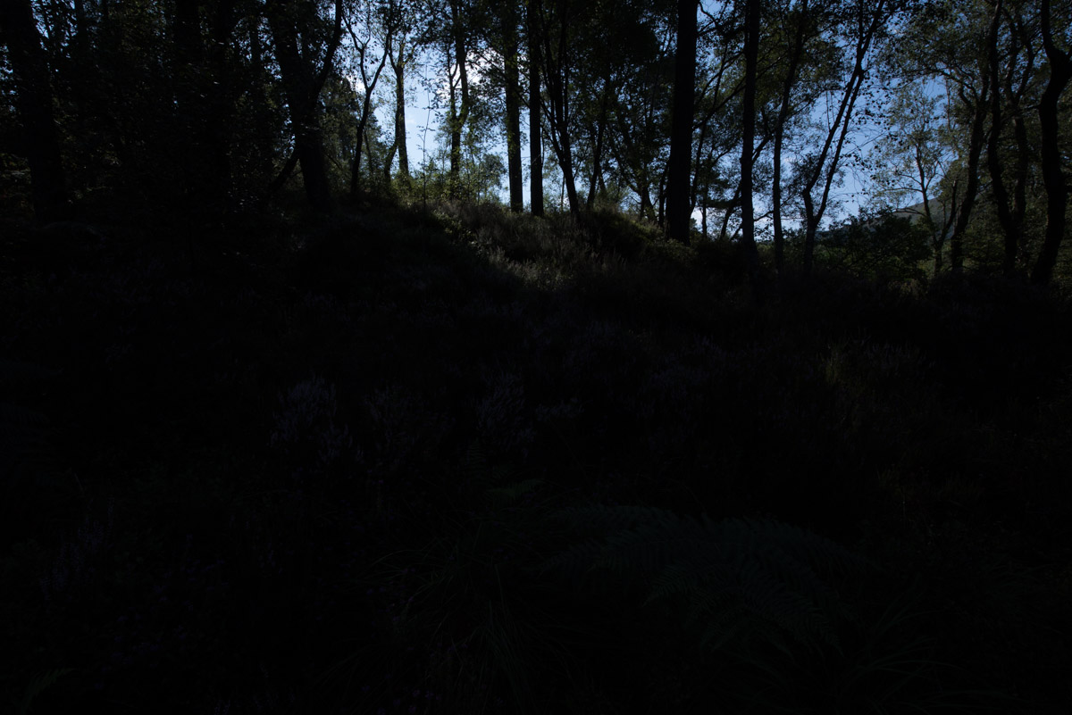
The highlight-weighted metering mode of the D750 considerably simplified shooting high-contrast scenes like this in the dark woods around Loch Lomond, left: uncorrected image straight from the camera, right: processed version with shadow details recovered in Lightroom.
Warm morning light and water smooth as glass greet us as we look out of our tent at a small deserted beach near Inversnaid.
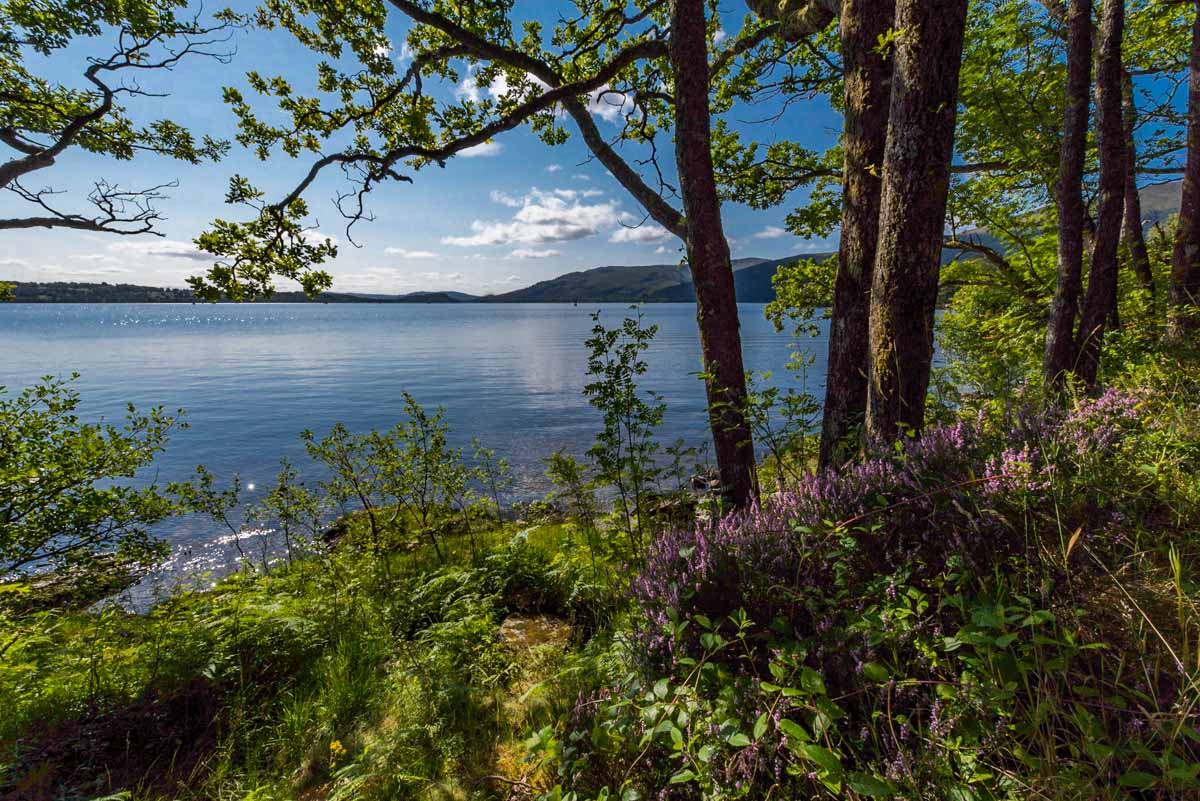
For the first three days, the West Highland Way offers great views of Loch Lomond, Scotland’s largest lake.

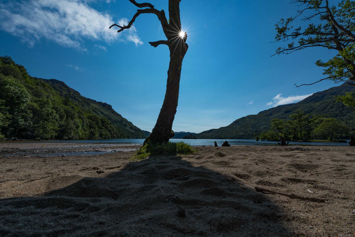
On the third day, we enjoy a warm and sunny afternoon at a beautiful beach at Loch Lomond.
At the northern end of Loch Lomond, we pass by Doune bothy, a basic night shelter that can be used free of charge by all hikers.
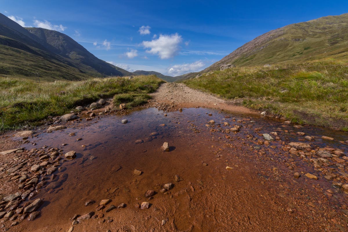
On the fourth day of our trip we finally leave Loch Lomond behind and continue our journey northward into the Highlands. Across an old military road, the first few kilometers of the trail lead us through Glen Falloch, a valley where the river Falloch forms numerous small cascades. Through colorful heath landscapes, we pass by the village of Crianlarich and the farmland of Auchtertyre, where we briefly rest among the ruins of Saint Fillan’s priory. We finally reach the small village of Tyndrum, a nice place to spend the night and also the last chance to restock food supplies for the next 42 kilometers of the trail. On the fifth day, we continue towards Bridge of Orchy, a small settlement known for its eponymous arch footbridge across the river Orchy. The area around the bridge is an excellent spot for landscape photography. Jumping from stone to stone in the river bed, you can get dramatic views of water cascades and the surrounding mountains. Here, my grey filter allowed me to get some long exposure shots of water cascades, which the bright sunshine would otherwise have rendered impossible. Along mountainous paths we finally continue our route towards the summit of Mam Carraigh, which provides a fantastic panoramic view over the Highlands and the deep blue waters of Loch Tulla.
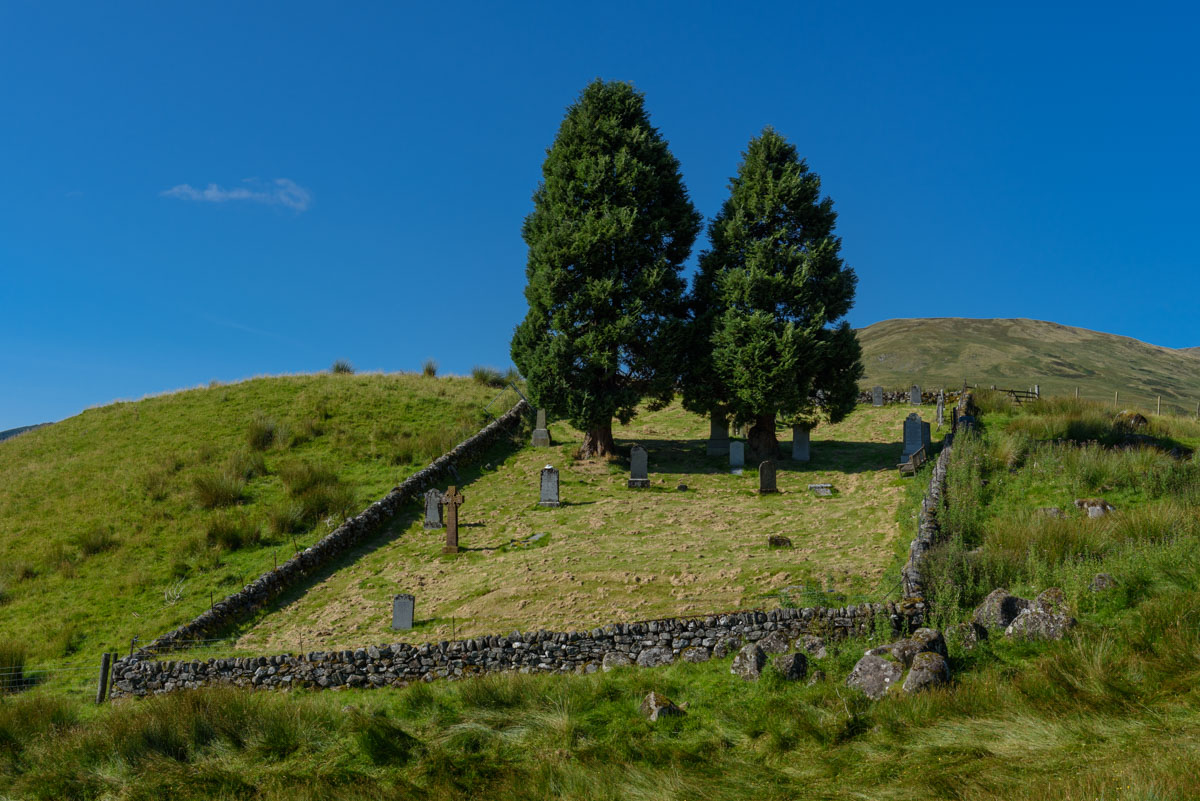
We pass by the picturesque ruins of an old graveyard close to Saint Fillan’s priory.
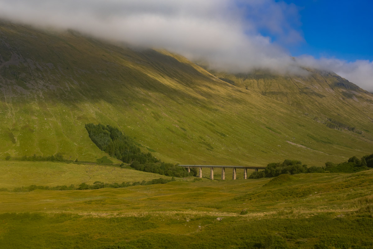
A viaduct in the valley of Orchy between Tyndrum and Bridge of Orchy.

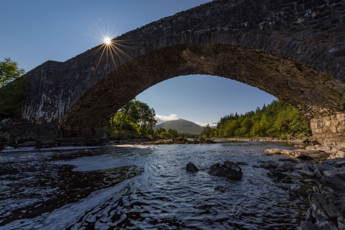
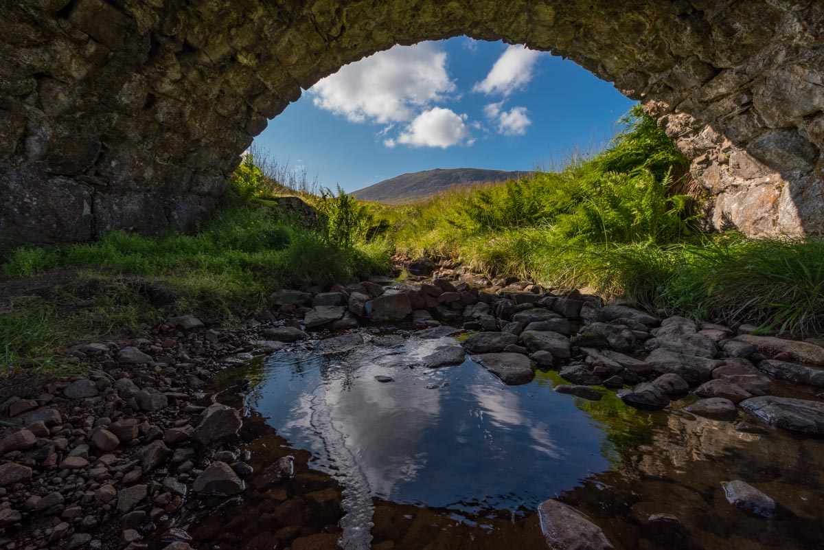
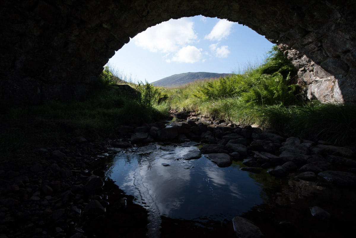
This stony footbridge across the river Orchy is the eponymous building of Bridge of Orchy, and vantage point for a number of great hikes across the valley of Orchy and Rannoch Moor.

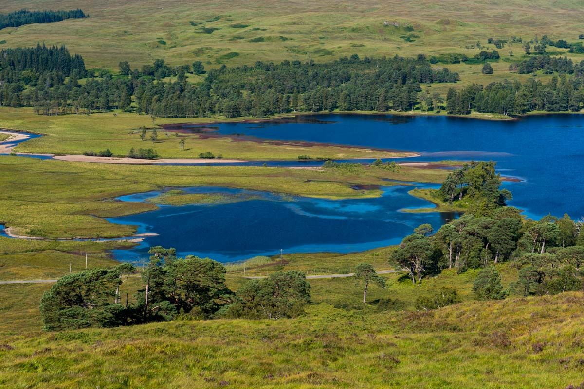
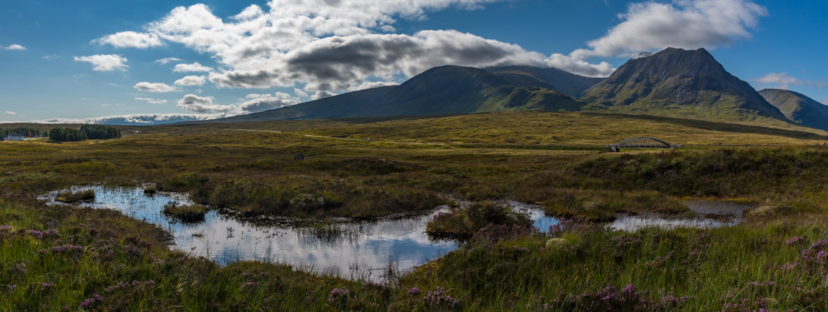
The summit of Mam Carraigh provides scenic views over the deep blue waters of Loch Tulla in the valley head.
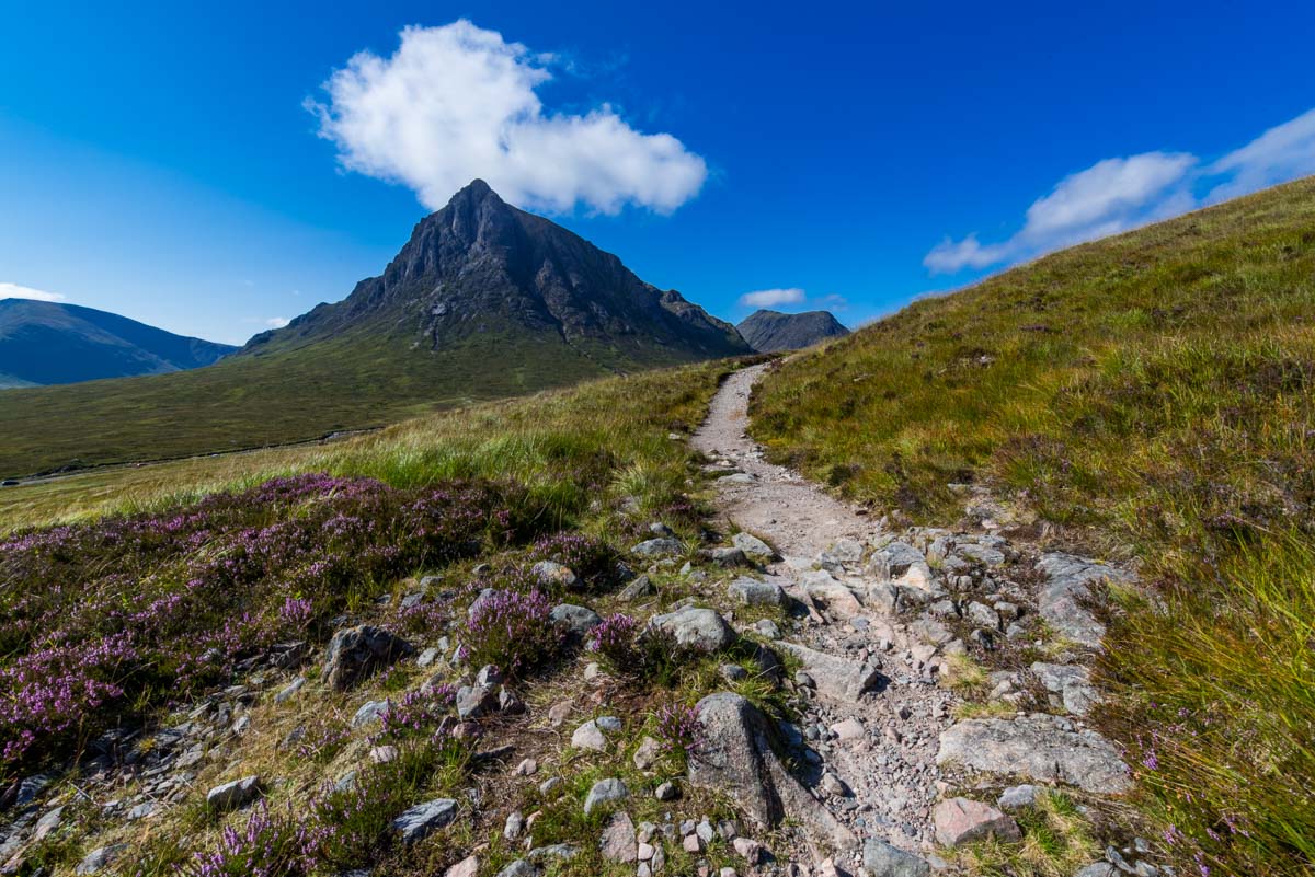
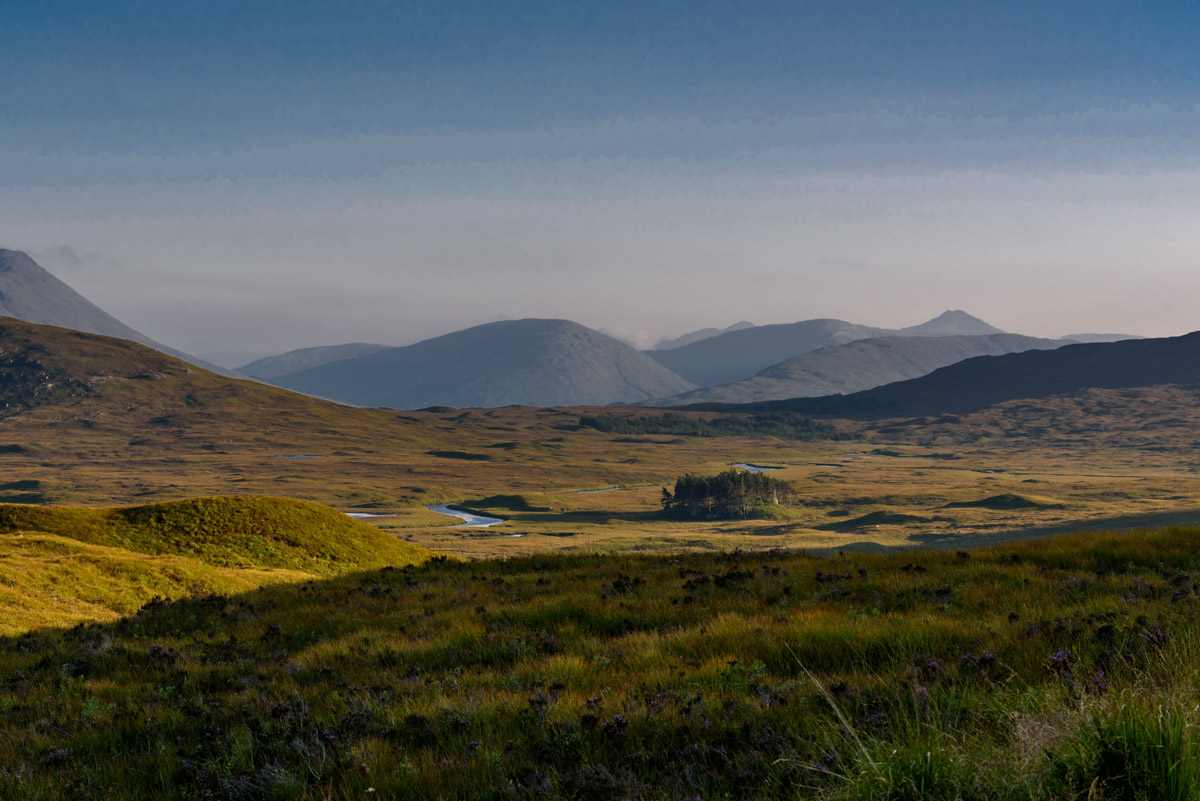
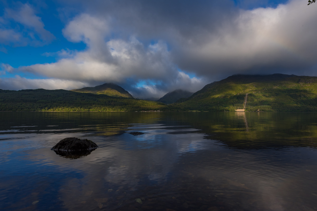
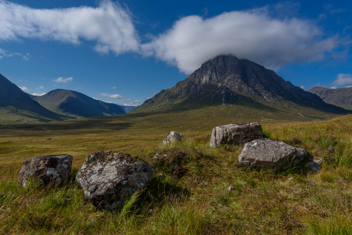
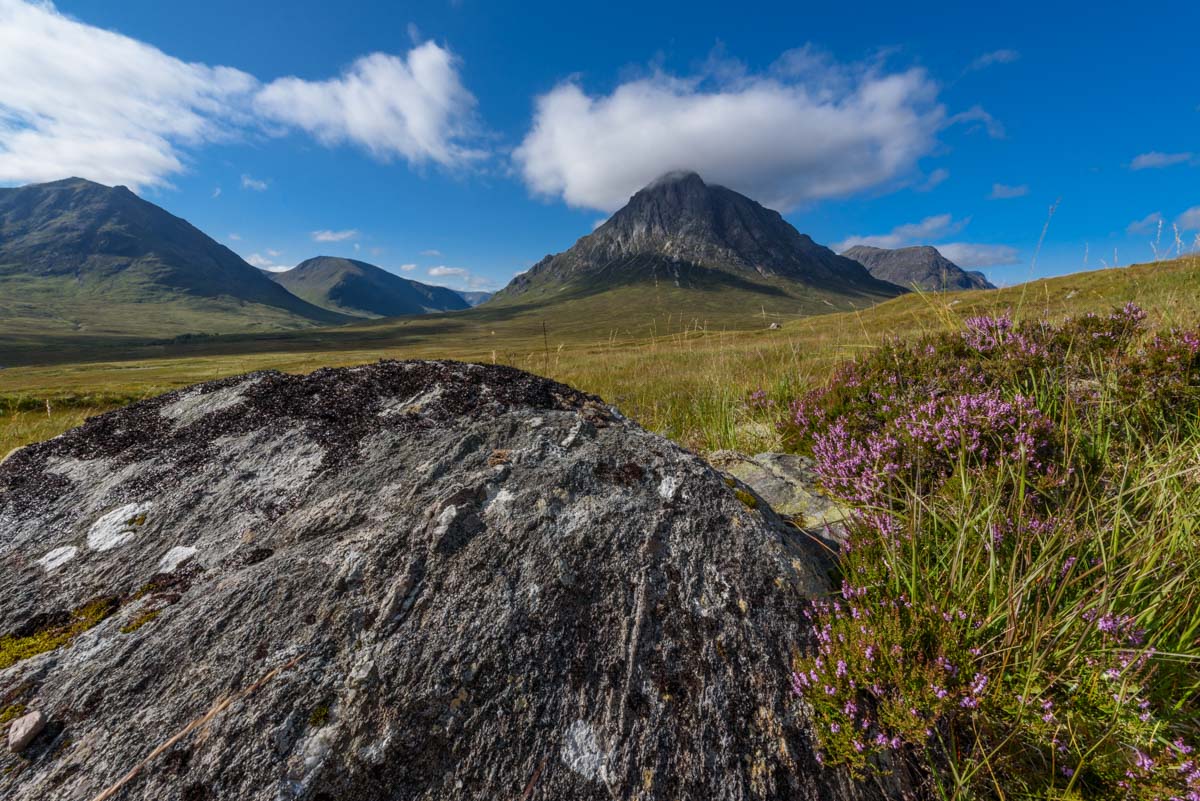
From Mam Carraigh, the West Highland Way descends towards Victoria Bridge, which crosses the river Shira near Loch Tulla. It then leads us to an old military road from the 18th century. Winding up the hills, the road next reaches Rannoch Moor, a wild and deserted moorland area that extends over more than 130 square kilometers. For the next hours, the old military road passes Rannoch Moor, with its vast open space, innumerable bog pools and typical, mossy vegetation. While the scenery of Rannoch Moor is spectacular under most conditions, it becomes almost magical when the sun begins to sink behind the mountains. The warmth of the last rays of light passing beneath the dark shadows of the surrounding mountain peaks and the intense purple color of the heathland provide dream conditions for photographers. Having extensively admired the sunset, we finally descend to the valley of Glen Coe, where we pitch our tents at the banks of river Etive. Here we are almost eaten by Highland Midges, a tiny fly that appears in huge black clouds between June and September and whose blood-sucking bites can literally drive you crazy. Fortunately, we are prepared and carry a mosquito net for the head. We quickly realize that without this essential piece of equipment we couldn’t even properly breath or open our eyes. Luckily, Highland Midges are extremely sensitive to wind, and just before we enter our tent for the night a fresh breeze relieves us from this plague.
An old military road from the 18th century leads us through Rannoch Moor.

For this shot from underneath an arch footbridge in Rannoch Moor, I again used the highlight-weighted metering mode of the D750, left: uncorrected image straight from the camera, right: processed version with shadow details recovered in Lightroom.
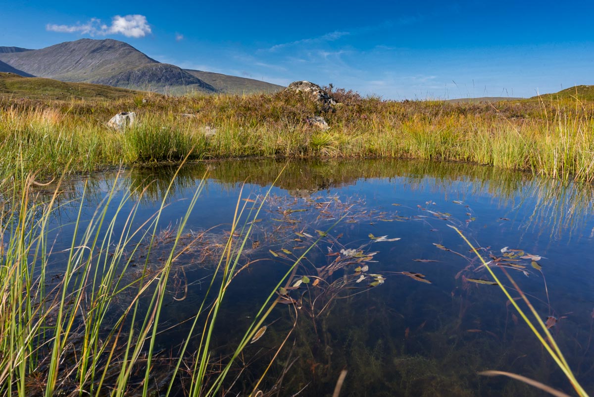
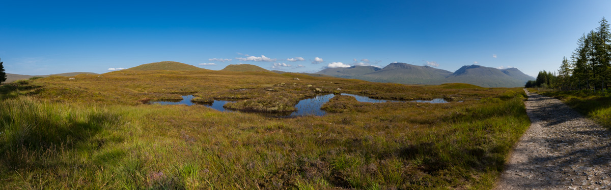
In Rannoch Moor, the West Highland Way passes by innumerable bog pools.

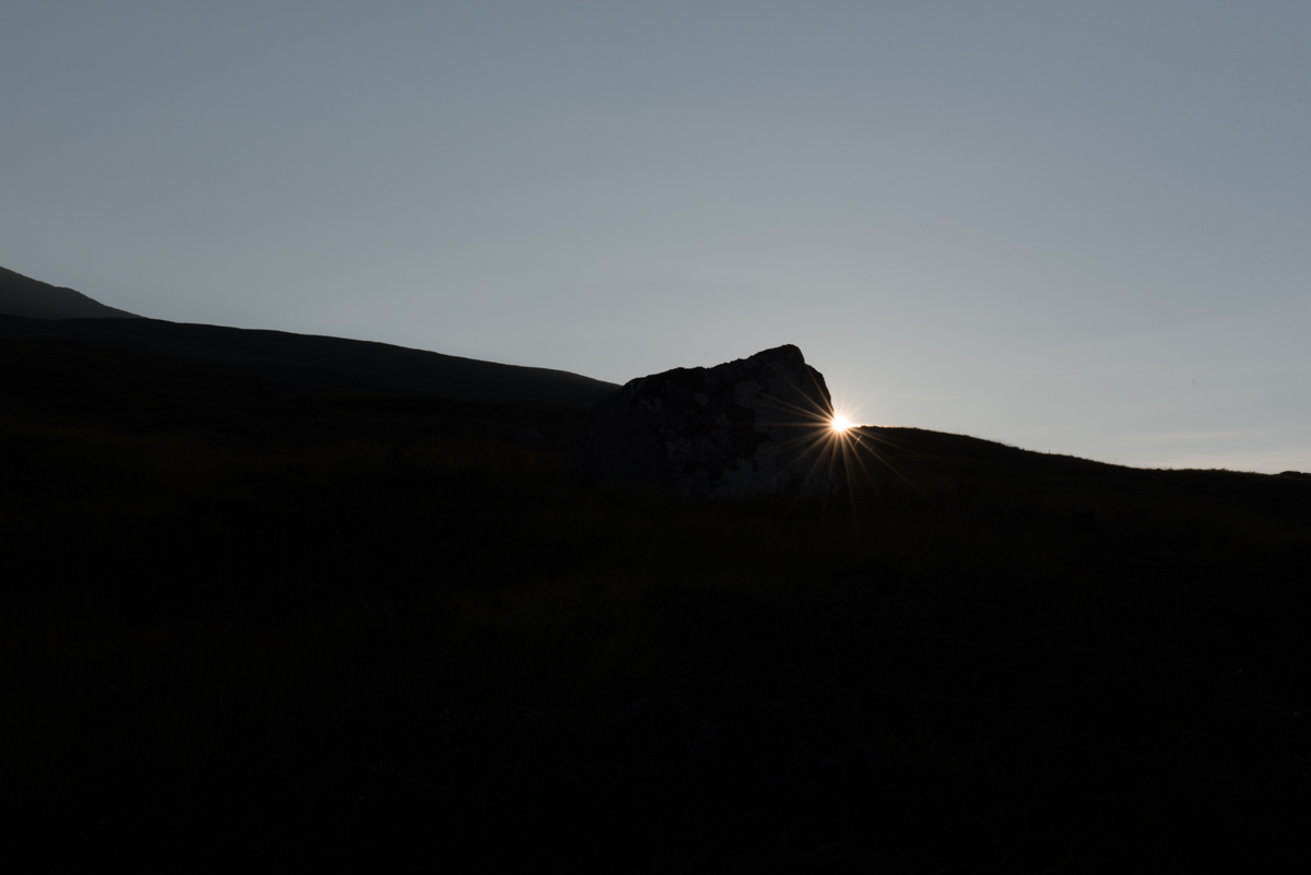
The setting sun bathes Rannoch Moor in golden light.

The warm light shortly before and after sunset adds an almost magical quality to the Highland scenery.
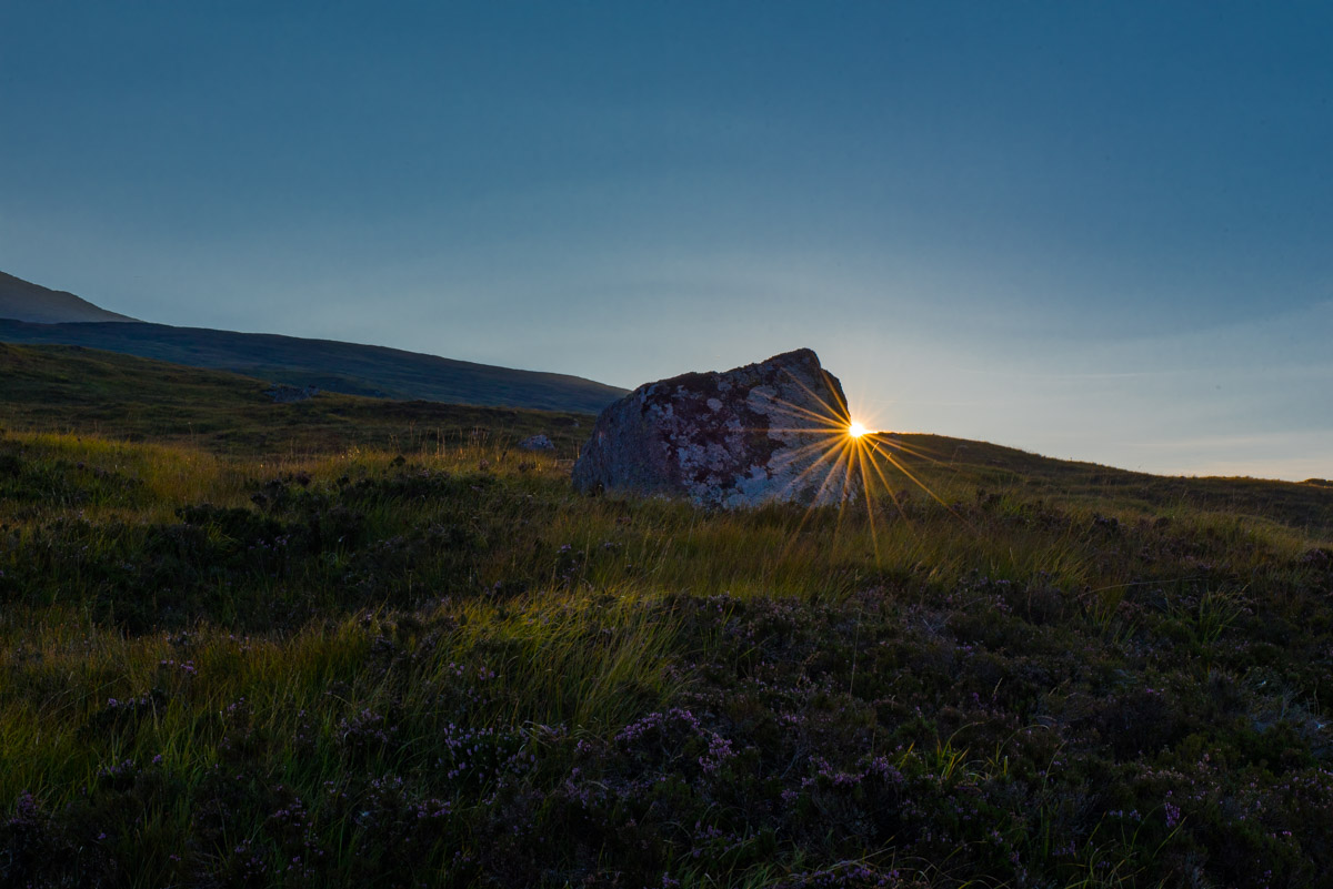
The sun sets over the heath landscape of Rannoch Moor. Again, this scene was shot with a single exposure using highlight-weighted metering, left: uncorrected image straight from the camera, right: processed version with shadow details recovered in Lightroom.
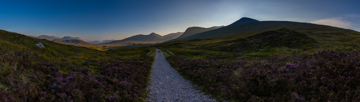
A look back along the old military road that crosses Rannoch Moor at its western fringe.
On the morning of the sixth day, we pack our tent and continue our hike along the river Etive through Glen Coe. Low clouds touch the peaks of the rugged mountains around us, as we pass through the valley. After some time, the trail turns right and climbs up the hills towards Devil’s staircase, a passage of natural, stony steps which help us to reach the summit of Stob Mhic Mhartuin. From here, we enjoy great views over Glen Coe and the surrounding Highland scenery, before continuing along mountainous paths towards Kinlochleven, which we reach in the afternoon. Located in a valley at the sea fjord Loch Leven, the village of Kinlochleven features a number of amenities such as a campsite, several pubs and restaurants as well as a small supermarket, where we again restock our food supplies.
Thanks to its rich history and scenic landscapes, Glen Coe is one of Scotland’s most famous mountain valleys.
Glen Coe: a composition of rocks, heath, mountains and clouds.

Devil’s Staircase, a mountain pass that takes us from Glen Coe to Loch Leven.
On the seventh, and final day of our trek the longest stage awaits us. Starting from the bottom of the valley in Kinlochleven, the trail first steeply climbs up to mountain pass of Lairigmor. In this high, narrow, unpopulated and windy valley, for endless kilometers the trail follows a small river, passing by farm ruins, small creeks, rocks and mountain peaks. In the afternoon, and after about 14 kilometers, we reach Lochan Lunn da Shra, a small picturesque lake that marks about half of today’s leg. From here, the West Highland Way slowly starts to descends from the Lairigmor pass towards Glen Nevis, a river valley at the foothills of Ben Nevis, the highest mountain on the British Isles. Through heathland and forests, the final part of the trail takes us to a road which eventually leads us to the center of Fort William. Here – after about 125 kilometers – we finally reach a stone bench that marks the official end of the West Highland Way.

The path through the valley of Lairigmor passes by this famous ruin of a farmhouse.
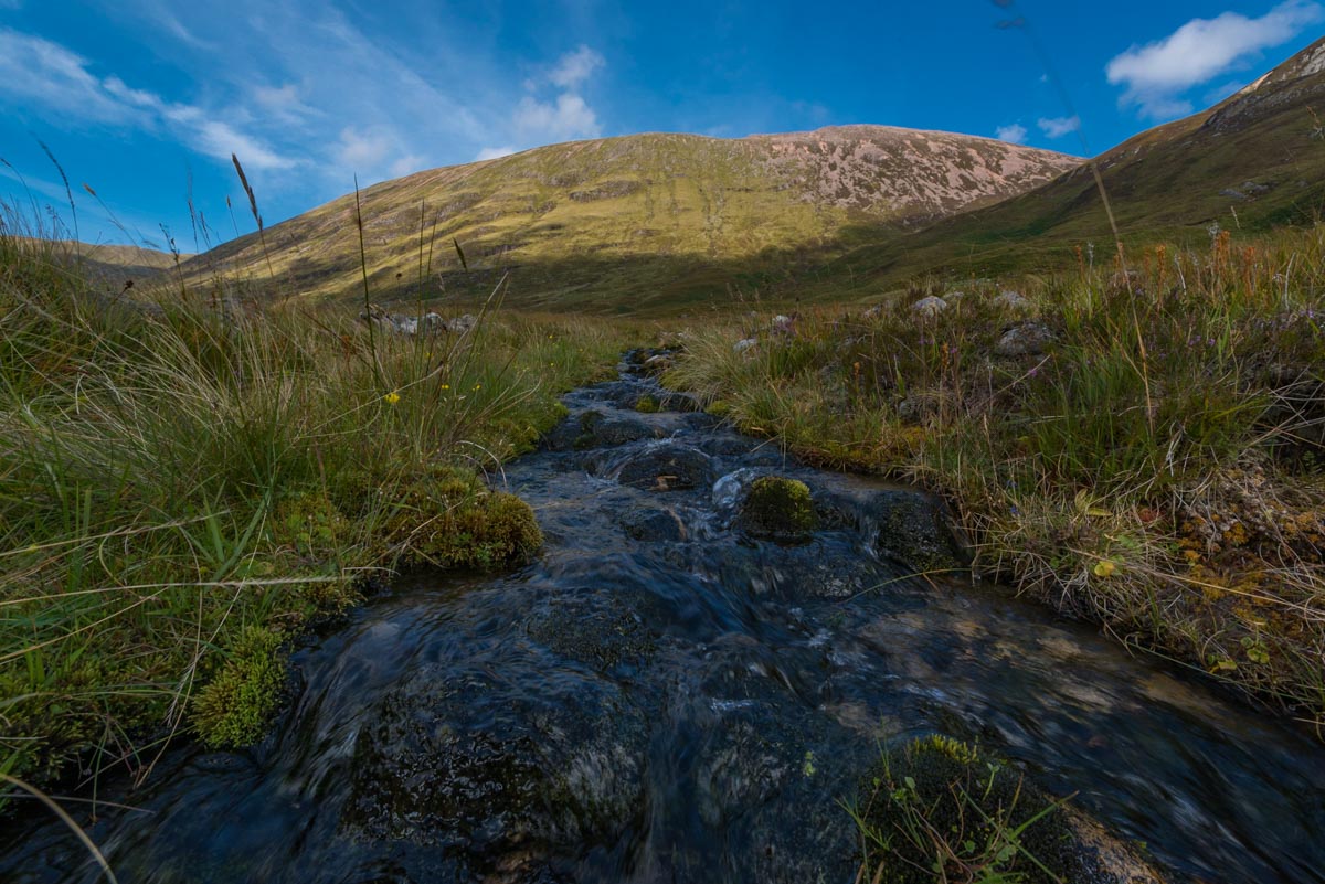
The water of countless small creeks falls down from the surrounding mountains peaks.

The cold and clear water is a welcome refreshment on the – for September – unusually sunny and hot days.
The road goes ever on and on …

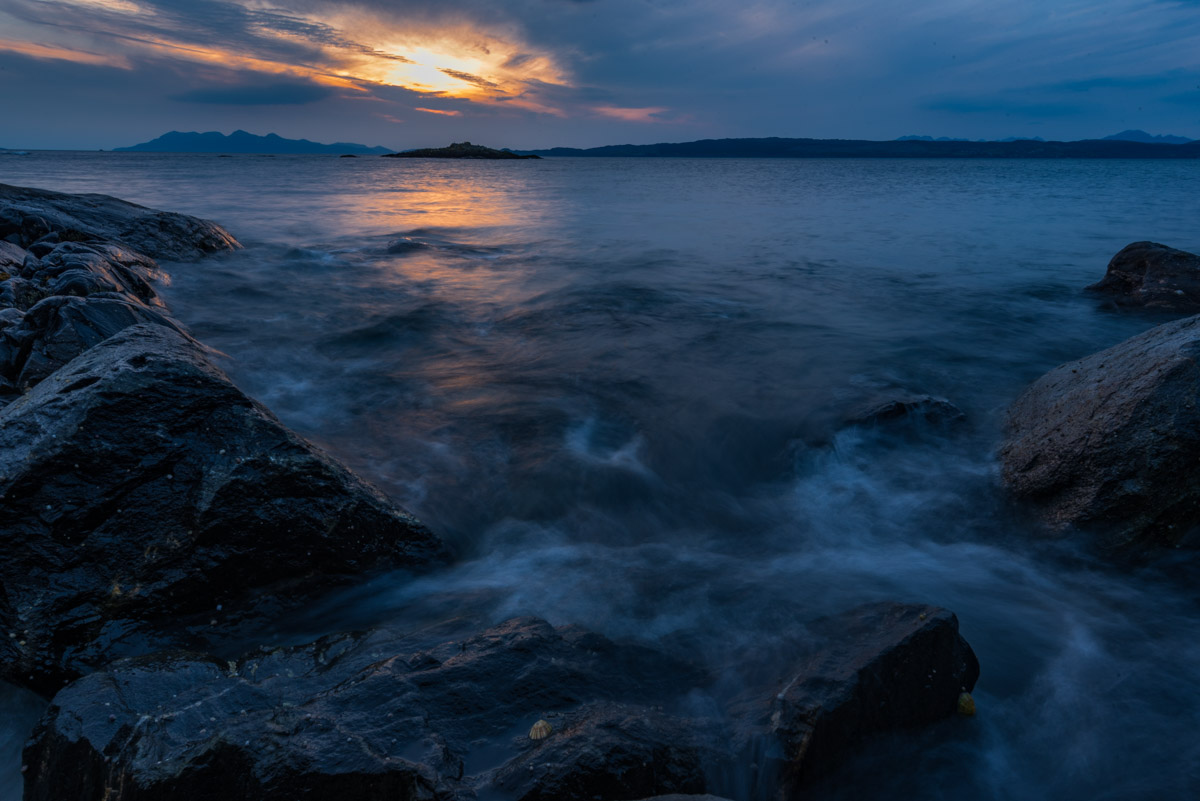
Ending in Fort William, the West Highland Way can easily be combined with a trip to Mallaig at the western coast. From here, ferries can take you to some of the Western Isles.
In summary, the West Highland Way is a fantastic trail both for hiking enthusiasts and landscape photographers. It will allow you to reach points in the Highlands that are largely inaccessible to cars, which means you will often be completely alone at extremely beautiful places. While the different stages can be planned in such a way that you can reach some (basic) accommodation at the end of each day, by carrying a tent you will gain a lot of freedom since you won’t have to rush along the most beautiful spots. However, it is clear that carrying both camping equipment and photographic gear along difficult and mountainous terrain can be cumbersome at times.
On our trip, we were particularly lucky with weather conditions. Sunshine, blue sky and a few low clouds provided quite favorable conditions for photography. However, I must say that I also missed a bit the quickly changing weather and light conditions that I had previously experienced on the Isle of Skye, and which would certainly be more typical for the Western Highlands. Due to the sunny weather, I was often confronted with strong contrasts that can make correct exposure a bit of a challenge like, e.g., shooting the sun setting in front of dark mountains or capturing the dark forest floor in front of the bright blue background sky.
In such situations, I found the highlight-weighted metering mode of the D750 quite useful. This mode automatically avoids any washout of highlights, at the expense of underexposing shadow areas. However, thanks to the excellent low-light capabilities of the D750, I knew that I wouldn’t have to worry about underexposing shadows by a few f-stops, at least when shooting at reasonable ISO settings of 800 or below. As you can see from the side-by-side comparison for the example shots shown above, I knew that I could later pull up the exposure of pitch-black shadows in Lightroom by several f-stops without introducing any recognizable noise. As a result, I didn’t lose any detail or color in the highlights, while still being able to recover shadow details. This is particularly handy on a long distance trekking tour, where you don’t want to lose a lot of time for repeatedly setting up your tripod and doing multi-frame HDR shots.
I hope you enjoyed these impressions from the Scottish Highlands and I sincerely hope that you get a chance to experience this characterful place yourself. If you are interested in more information (and photographic impressions) of this and other tours, just visit the outdoors section of my website. Here, you will find detailed trail information not only for my tour along the West Highland Way, but also for my previous trek across the Skye Trail.
If you have an interesting idea for a guest post, you can contact me here.